Difficulty level
TC/MC
Bicycle - Gravel
Bicycle - MTB
The Val di Sterza and the Caselli Forest
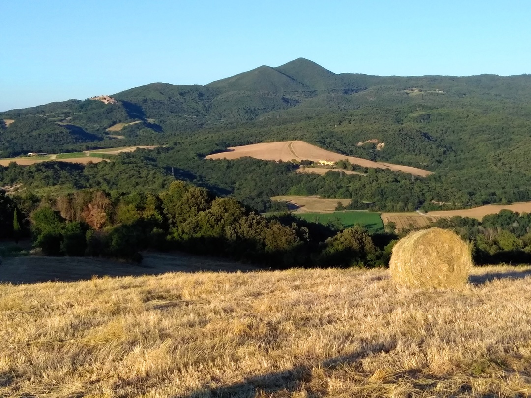
A broad, spectacular cycling route that will take you through a large section of the Val di Sterza, plunging right trough the wild heart of the Caselli forest and then upwards to the ridge of the Monti della Gherardesca.
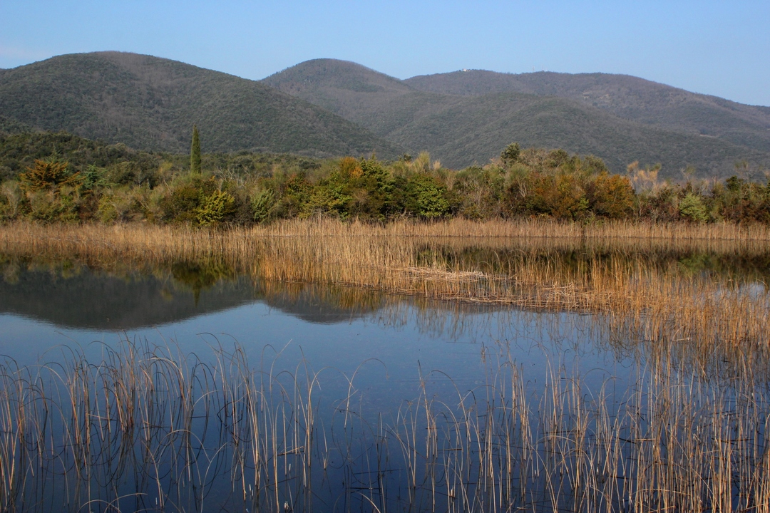
From the picnic area at La Pompa, you will immediately enter the Nature Reserve. Once inside it you will take a dirt road immersed in a beautiful turkey oak wood that will lead you to the magic Caselli pond, a must-see and must-stop spot with amazing views and equally amazing flora, a spot which is also the head of several itineraries to suit all tastes.
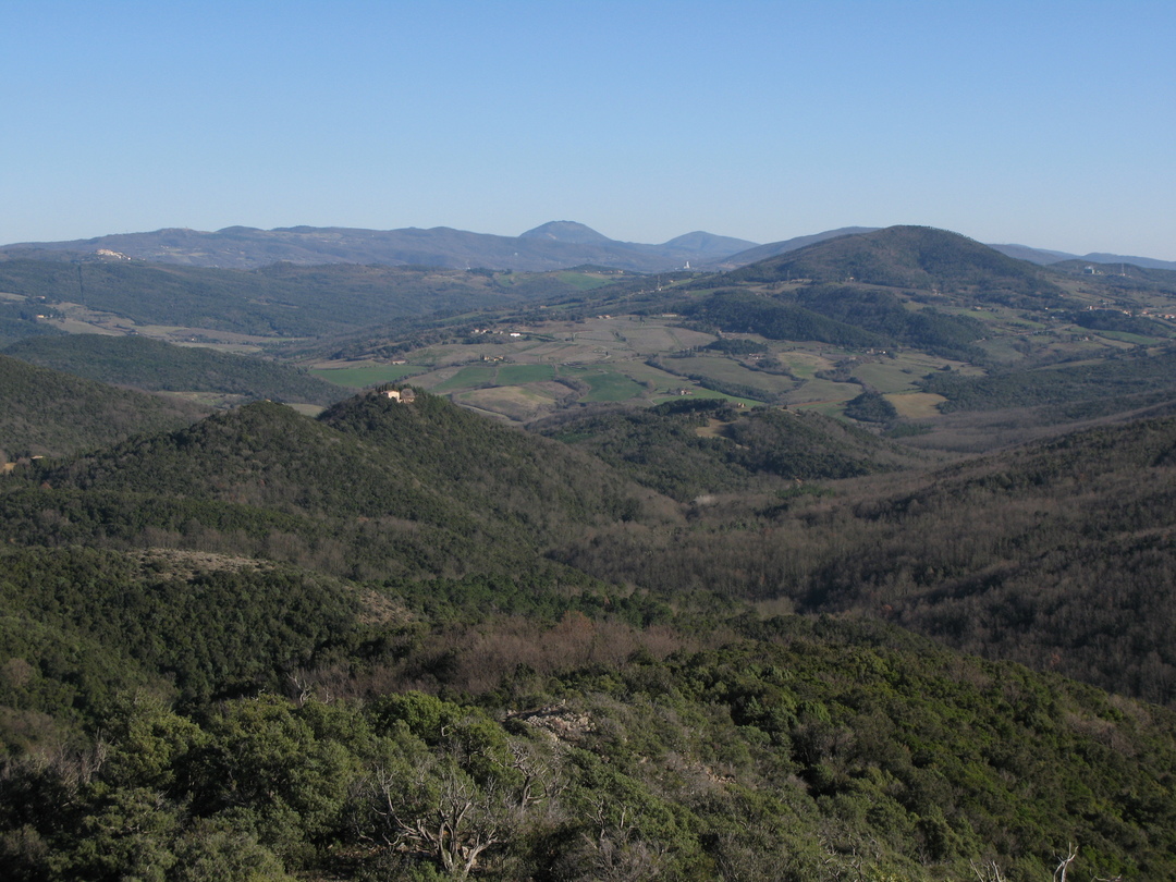
By going upwards still you will go through the wild heart of the Caselli forest where, amidst rocks and shrubs, you will be treated to an apparently endless series of breathtaking views. The garigues on the snakelike rock outcrops dot the landscape with their unique flora and rare and unusual spring blooms.
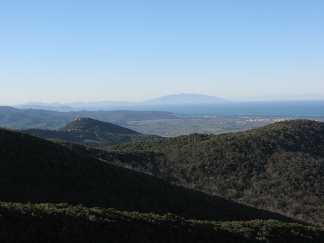
Once you have reaching the ridge, near the reserve boundary bar, we recommend taking a short detour to visit the Golazze Aperte, a rocky outcrop in a splendid scenic position from which you may enjoy the amazing view of the Etruscan Coast and the Tuscan Archipelago. Next you will enter the Magona evergreen forest – intensively cut since the 16th century to obtain wood for the ironworks of Cecina – and then take the scenic Faltona Road, which descends down into the Val di Sterza, allowing you to enjoy different natural environments and amazing landscape views stretching as far as Volterra.
At the bottom of the valley tale the Quattro Comuni provincial road to quickly return to the starting point.