Difficulty level
MC/OC
Bicycle - MTB
On Horseback
Landscapes, castles and rivers between Pomarance and the Berignone Nature Reserve
The descent on the path between Podere Casinieri and Masso delle Fanciulle (from km 13.5 to about km 15.5), and the part with the ford on the Possera stream (from km 28 to about km 28.5) is a very hard section requiring a very high level of technical skill. The first part, from Km 0.6 to about Km 1 instead requires an above average level of technical skill.
Due to the large number of fords, we do not recommend taking this route after heavy rain days.
A variant, visible on the map allows you to customise the route and reduce the length of the “ring”.
Enchanting views, boundless forests, gentle landscapes and crystal-clear waters, sightings of birds of prey and, with a bit of luck, even wolves: all this in a single, must-try itinerary! Before setting off, take a stop in the old town centre of Pomarance with its 12th century parish church, the Piazza della Pretura and the beautiful 19th century buildings in Via Roncalli, including the Casa Museo Palazzo Bicocchi, a 19th century bourgeois residence, Palazzo Ricci with its permanent exhibition “Guerrieri ed Artigiani (dalla Preistoria al Rinascimento” (Warriors and Craftsmen, from Prehistory to the Renaissance) as well as the two sophisticated theatres, De Larderel and Dei Coraggiosi.
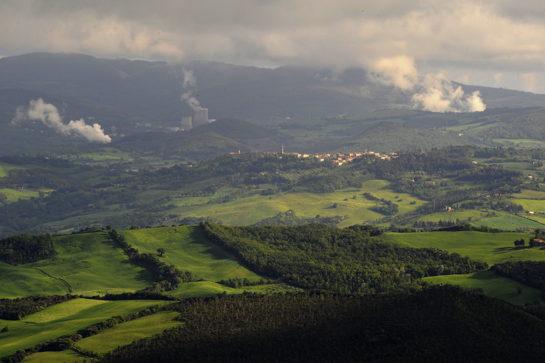
The route starts from the centre, and you will see the countryside and its lively and beautiful farmhouses, slowly leaving room, at the bottom of the valley, to the important river ecosystems of the Cecina and the Fosci and Sellate streams. After crossing the Cecina you will follow the Fosci valley floor, with its hygrophilous flora (poplars and willows), until you will reach the Berignone Nature Reserve.
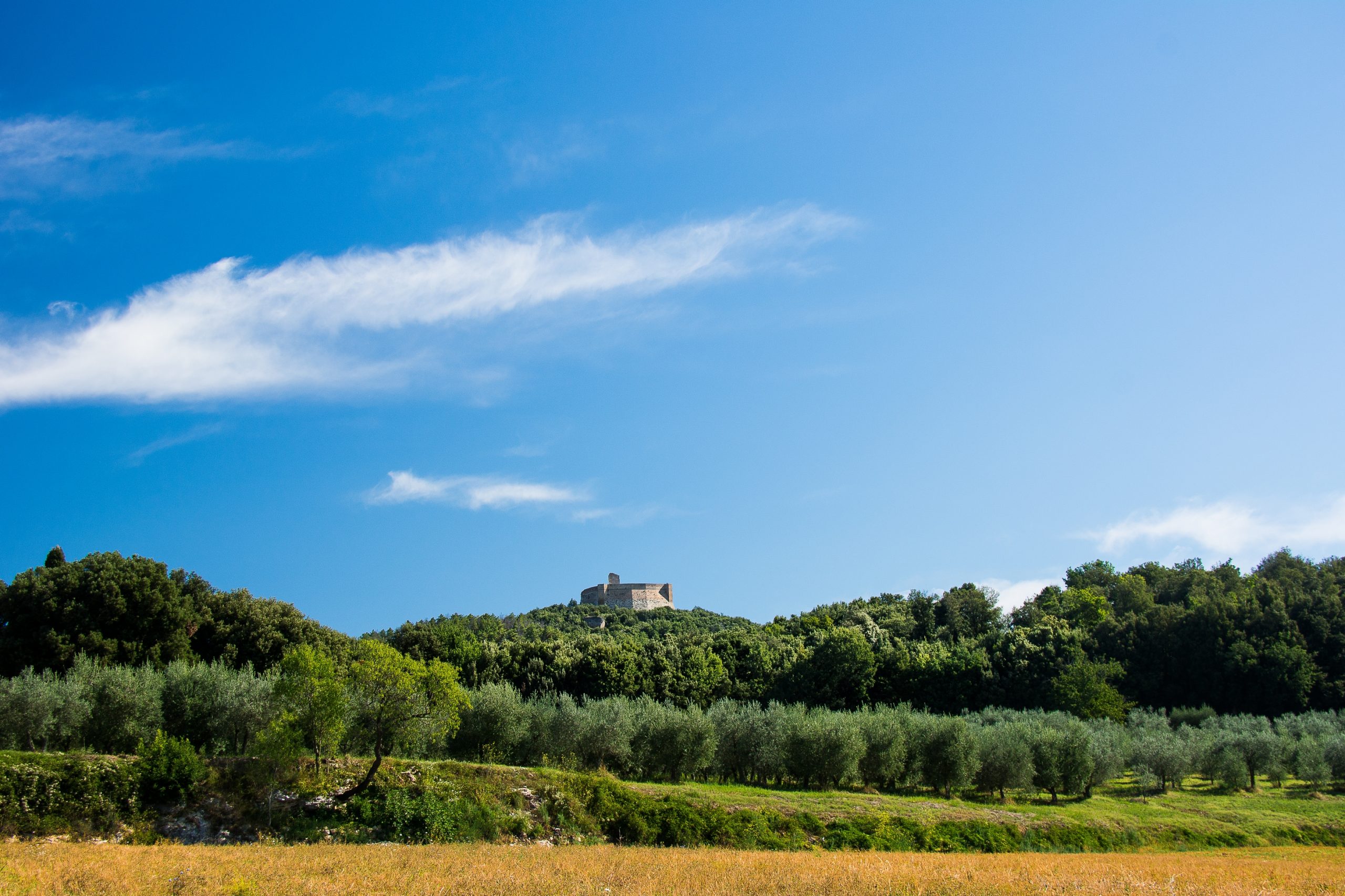
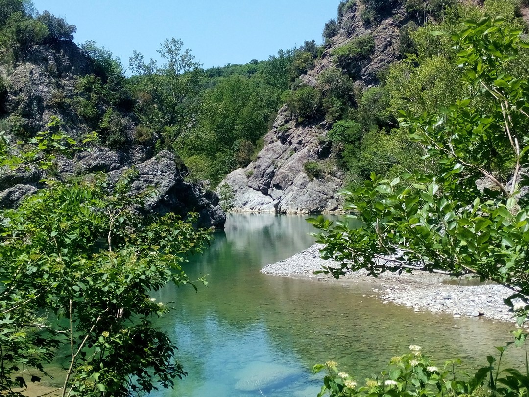
From there a road (actually a tunnel through the forest) will take you to the Casinieri hill, where your gaze may stray and wander to reach the Cecina gorge, the Pavone gorge and Rocca Sillana. From there you will pass through the most important places in the Reserve, then descend towards the clear waters of the Cecina River, where the watercourse is squeezed between rocky masses, showing its most beautiful face and you will find yourself in one of the most enchanting and best-preserved river environments in Italy, the Masso delle Fanciulle and the Masso degli Specchi, an ideal place to take a regenerating dip.
On the way back to Pomarance you will enjoy a series of unparalleled views and find yourself at the foot of the imposing Rocca Sillana, an ancient Medici fortress overlooking the wild valley of the Pavone stream, and then you will reach the enchanting village of San Dalmazio and pass through the countryside that blends an ancient, timeless area with present day frenetic working activities, until you will reach Pomarance again.