Difficulty level

TC/MC

Mit dem Fahrrad - Gravel

Mit dem Fahrrad - MTB

Val di Sterza und der Caselli-Wald

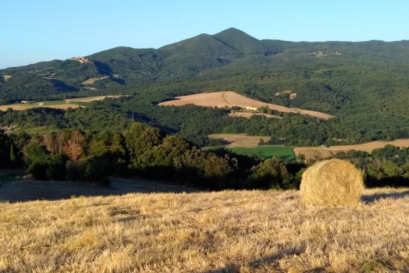
A broad, spectacular cycling route that will take you through a large section of the Val di Sterza, plunging right trough the wild heart of the Caselli forest and then upwards to the ridge of the Monti della Gherardesca.

From the picnic area at La Pompa, you will immediately enter the Nature Reserve. Once inside it you will take a dirt road immersed in a beautiful turkey oak wood that will lead you to the magic Caselli pond, a must-see and must-stop spot with amazing views and equally amazing flora, a spot which is also the head of several itineraries to suit all tastes.

By going upwards still you will go through the wild heart of the Caselli forest where, amidst rocks and shrubs, you will be treated to an apparently endless series of breathtaking views. The garigues on the snakelike rock outcrops dot the landscape with their unique flora and rare and unusual spring blooms.

Once you have reaching the ridge, near the reserve boundary bar, we recommend taking a short detour to visit the Golazze Aperte, a rocky outcrop in a splendid scenic position from which you may enjoy the amazing view of the Etruscan Coast and the Tuscan Archipelago. Next you will enter the Magona evergreen forest – intensively cut since the 16th century to obtain wood for the ironworks of Cecina – and then take the scenic Faltona Road, which descends down into the Val di Sterza, allowing you to enjoy different natural environments and amazing landscape views stretching as far as Volterra.

At the bottom of the valley tale the Quattro Comuni provincial road to quickly return to the starting point.

Continue

Itinerary

X

A broad, spectacular cycling route that will take you through a large section of the Val di Sterza, plunging right trough the wild heart of the Caselli forest and then upwards to the ridge of the Monti della Gherardesca.

From the picnic area at La Pompa, you will immediately enter the Nature Reserve. Once inside it you will take a dirt road immersed in a beautiful turkey oak wood that will lead you to the magic Caselli pond, a must-see and must-stop spot with amazing views and equally amazing flora, a spot which is also the head of several itineraries to suit all tastes.

By going upwards still you will go through the wild heart of the Caselli forest where, amidst rocks and shrubs, you will be treated to an apparently endless series of breathtaking views. The garigues on the snakelike rock outcrops dot the landscape with their unique flora and rare and unusual spring blooms.

Once you have reaching the ridge, near the reserve boundary bar, we recommend taking a short detour to visit the Golazze Aperte, a rocky outcrop in a splendid scenic position from which you may enjoy the amazing view of the Etruscan Coast and the Tuscan Archipelago. Next you will enter the Magona evergreen forest – intensively cut since the 16th century to obtain wood for the ironworks of Cecina – and then take the scenic Faltona Road, which descends down into the Val di Sterza, allowing you to enjoy different natural environments and amazing landscape views stretching as far as Volterra.

At the bottom of the valley tale the Quattro Comuni provincial road to quickly return to the starting point.

X

Hiking difficulty scale

T - Tourist

Itineraries on small roads, mule tracks or easy paths, with clearly evident routes that do not pose uncertainties or problems of orientation. They generally take place below 2000 m and usually constitute access to mountain pastures or refuges. They require some knowledge of the mountain environment and physical preparation for walking.

E - Hiking

Routes that almost always turn on paths, or on traces of passage in various terrain (pastures, debris, stony ground), usually with signs. They require a certain sense of orientation, as well as a certain experience and knowledge of the mountainous territory, walking training, as well as appropriate footwear and equipment. Normally the difference in altitude is between 500 and 1000m.

EE - Expert hikers

Routes not always marked and which require a good ability to move on various mountain terrains. They can be paths or even faint traces that wind over rough or steep terrain, with steep and slippery slopes, scree and short snowfields that can be overcome without the use of climbing equipment. They need a good mountain experience, firm footing and good physical preparation. It is also necessary to have adequate equipment and equipment, as well as a good sense of direction. Normally the difference in height is greater than 1000m.

EEA - Expert hikers with mountaineering equipment

Routes that require the use of via ferrata equipment (lanyards, harness, heat sink, helmet, etc.). They can be equipped paths or real via ferratas. It is necessary to know how to use the technical equipment safely and have a certain habit of exposure and mountaineering terrain.

MTB difficulty scale

TC - Tourist

Route on dirt roads with a compact and smooth surface, suitable for vehicles.

BC - For cyclists with good technical skills

Route on very bumpy dirt roads or on mule tracks and paths with a rather bumpy but fairly smooth surface or compact but irregular, with some natural obstacles (eg rock steps or roots).

OC - For cyclists with excellent technical skills

As above but on very bumpy and / or very irregular paths, with significant presence of obstacles.

EC - Maximum level for the cycle excursionist

Path on very irregular paths, characterized by steps and obstacles in continuous succession, which require trial-type techniques.

Menu
Share This