Mit dem Fahrrad - Gravel

Mit dem Fahrrad - MTB

Montecatini V.C. und das Holz von Decimo

Die Sonderziele sind nur im außerstädtischen Bereich beschrieben

Montecatini V. C.’s territory is a large hilly area, with a thick wood and very few inhabitants and rural, historic and natural strikingly beautiful and well preserved features. From the Montecatini central square you can take an upwards path to the well known Miniera di Caporciano, which in the 19th century was the largest copper mine in Europe. Here you can go through the 19th century miners’ village and the S. Barbara church, the mine’s administration offices, the Villa dei Signori and the typical watchtower guarding the mine forecourt. Once past the forecourt and the entrance to the tunnel leading to the mine, you can take the Gello municipal road downhill and then turn onto a dirt road towards Lago di Scandri and the farm of the same name, which is also the last village before entering the forest.

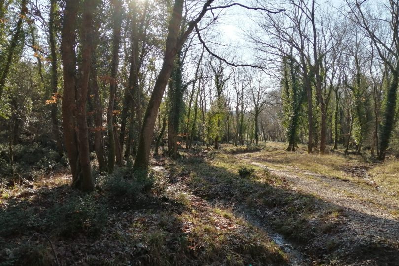
From there you will thread on a well kept dirt road down into the heart of the Decimo forest, which is now officially a public property but which has been a well known and precious source of timber, beginning in the middle ages and up to the days of the Saline di Volterra state-owned saltwork.

At Decimo, deciduous broadleaf trees (mostly turkey oaks) alternate with Mediterranean evergreen shrubs and a patch of lowland forest typical of hilly valley floors, with trees such as the southern ash and white hornbeam. From then you can move back to a paved road that crosses with a flat part of SR 68.

After passing the village of Ponteginori you then go back to Gello via one of the most beautiful (with little to no traffic) scenic roads in the Cecina Valley and enjoy a breathtaking landscape featuring woods and open fields; you can also enjoy views over much of the Cecina Valley as well as the peace and quiet of the small Etruscan village of Gello and its ancient castle in Volterra.

The appearing of the mighty Belforti tower (11th century), which dominates the stunningly beautiful village of Montecatini, will mean that you have now returned to the starting point and can now lose yourself in the quiet, discreet alleys and small squares of the village, rest in Piazza della Repubblica enjoying it or visit the old mine.

Continue

Itinerary

X

Die Sonderziele sind nur im außerstädtischen Bereich beschrieben

Montecatini V. C.’s territory is a large hilly area, with a thick wood and very few inhabitants and rural, historic and natural strikingly beautiful and well preserved features. From the Montecatini central square you can take an upwards path to the well known Miniera di Caporciano, which in the 19th century was the largest copper mine in Europe. Here you can go through the 19th century miners’ village and the S. Barbara church, the mine’s administration offices, the Villa dei Signori and the typical watchtower guarding the mine forecourt. Once past the forecourt and the entrance to the tunnel leading to the mine, you can take the Gello municipal road downhill and then turn onto a dirt road towards Lago di Scandri and the farm of the same name, which is also the last village before entering the forest.

From there you will thread on a well kept dirt road down into the heart of the Decimo forest, which is now officially a public property but which has been a well known and precious source of timber, beginning in the middle ages and up to the days of the Saline di Volterra state-owned saltwork.

At Decimo, deciduous broadleaf trees (mostly turkey oaks) alternate with Mediterranean evergreen shrubs and a patch of lowland forest typical of hilly valley floors, with trees such as the southern ash and white hornbeam. From then you can move back to a paved road that crosses with a flat part of SR 68.

After passing the village of Ponteginori you then go back to Gello via one of the most beautiful (with little to no traffic) scenic roads in the Cecina Valley and enjoy a breathtaking landscape featuring woods and open fields; you can also enjoy views over much of the Cecina Valley as well as the peace and quiet of the small Etruscan village of Gello and its ancient castle in Volterra.

The appearing of the mighty Belforti tower (11th century), which dominates the stunningly beautiful village of Montecatini, will mean that you have now returned to the starting point and can now lose yourself in the quiet, discreet alleys and small squares of the village, rest in Piazza della Repubblica enjoying it or visit the old mine.

X

Hiking difficulty scale

T - Tourist

Itineraries on small roads, mule tracks or easy paths, with clearly evident routes that do not pose uncertainties or problems of orientation. They generally take place below 2000 m and usually constitute access to mountain pastures or refuges. They require some knowledge of the mountain environment and physical preparation for walking.

E - Hiking

Routes that almost always turn on paths, or on traces of passage in various terrain (pastures, debris, stony ground), usually with signs. They require a certain sense of orientation, as well as a certain experience and knowledge of the mountainous territory, walking training, as well as appropriate footwear and equipment. Normally the difference in altitude is between 500 and 1000m.

EE - Expert hikers

Routes not always marked and which require a good ability to move on various mountain terrains. They can be paths or even faint traces that wind over rough or steep terrain, with steep and slippery slopes, scree and short snowfields that can be overcome without the use of climbing equipment. They need a good mountain experience, firm footing and good physical preparation. It is also necessary to have adequate equipment and equipment, as well as a good sense of direction. Normally the difference in height is greater than 1000m.

EEA - Expert hikers with mountaineering equipment

Routes that require the use of via ferrata equipment (lanyards, harness, heat sink, helmet, etc.). They can be equipped paths or real via ferratas. It is necessary to know how to use the technical equipment safely and have a certain habit of exposure and mountaineering terrain.

MTB difficulty scale

TC - Tourist

Route on dirt roads with a compact and smooth surface, suitable for vehicles.

BC - For cyclists with good technical skills

Route on very bumpy dirt roads or on mule tracks and paths with a rather bumpy but fairly smooth surface or compact but irregular, with some natural obstacles (eg rock steps or roots).

OC - For cyclists with excellent technical skills

As above but on very bumpy and / or very irregular paths, with significant presence of obstacles.

EC - Maximum level for the cycle excursionist

Path on very irregular paths, characterized by steps and obstacles in continuous succession, which require trial-type techniques.

Menu
Share This